fbpx Diaries for Explore Outdoors | LEARNZ

Diaries for Explore Outdoors

Keep up to date with Teanau the LEARNZ Teacher during this field trip.

Day three–Thursday February 20

View this post on Instagram

Diary Day 3 Today we got to take a bit of a wander around Roys Peak which was a great reminder that getting outdoors is really great for our physical and mental wellbeing. I was also mindful about the impact of large numbers of visitors can have on our more prominent tracks and how that could be lessened by people using less well known tracks that are just as awesome! Also we some frogs! It's amazing what you can see out on the trails! Stephen Day from The Walking Access Commission Ara Hīkoi Aotearoa should us how we can use their website to plan your own adventure. Which you can check out here. https://www.walkingaccess.govt.nz/find-my-adventure/#/ They are also have a competition - the Top Outdoor Spot 2020 which promote access to the outdoors. The competition runs until 4 July 2020. School children send in a photo, artwork or poem/story of their favourite outdoor spot. The top three entries in each category won a prize pack for themselves and/or their school. The three categories are: Best Photo Best Art, and Best Writing https://www.walkingaccess.govt.nz/education-space/tos/top-outdoor-spot/ Ka kite - See you on the trails! #LearnzExploreOutdoors #Learnz #WalkingAccess #thatwanakatree #wellbeing @walkingaccess

A post shared by LEARNZ Virtual Field Trips (@learnztrips) on

Day two–Wednesday February 19

View this post on Instagram

Caring for the outdoors. Protecting the environment on private land. Diary Day 2 We had a great trip up the Matukituki Valley where we spent time with Randall Aspinall and his family up at the Aspiring Station. He is a fourth-generation farmer on Mt Aspiring Station, a 2300ha property that is a gateway into Mt Aspiring National Park. It is estimated that more than 100,000 people — climbers, trampers, walkers and tourists — come on to the property each year. We talked about how visitors could behave responsibly on private land in ways that help keep the Matukituku valley intact supporting the environment and animals that call the valley home. We also spent time with Rob Wardle from the QEII National Trust. They partner with landowners to protect special places on private land for the benefit of present and future generations. Protecting private land via a QEII National Trust covenant is the most efficient and effective way to help protect the habitat of threatened animal and plant species. All of this needs to be supported by predator control and we talked to Paul Hellebrekers he showed us how his traps work and how that links in with helping threatened species to survive. In the Matukituku Valley this work is aimed at safeguarding populations of threatened native birds from predation including kea, kaka, South Island robin, rock wren as well as long-tailed bats. Great Day! - Mauri Ora! #LEARNZ #LEARNZexploreoutdoors #biodiversity #QEIINationalTrust #WalkingAccess #mtaspiringnationalpark #workingwithfarmers #virtualfieldtrip

A post shared by LEARNZ Virtual Field Trips (@learnztrips) on

Watch the Videos for Day two and meet the Experts for Day two.

Day one–Tuesday February 18

View this post on Instagram

Explore Outdoors: Opening up Aotearoa for everyone. Diary Day 1. Up up and away.... Exploring Wānaka Today we got to take a helicopter ride around the Wānaka region, over the Matukituki Valley and around Roys Peak over the Blue Pools and up close to the Glaciers. The dramatic blue lakes and rugged mountain ranges of the Wānaka region form a spectacular backdrop to the pristine wilderness of Tititea / Mount Aspiring National Park and its superb hiking opportunities. I learnt that Wānaka was formed by rolling glaciers that moved slowly forming the lakes and valleys that make up the region. Our helicopter pilot Bill Day is a Search and Rescue pilot and also a treasure hunter, he was involved in three expeditions to recover gold from the wreck of the General Grant in the sub Antarctic Auckland Islands. We were fortunate to have Bill as our pilot and guide to explore this region. Bill said that there are around fifty Search and Rescue missions made each year and those that took personal locator beacons are easier to track because satellites help to find where they are quite precisely. The vast and rugged terrain of the country means that visitors need to be prepared while outdoors especially on overnight tramps because the weather can turn suddenly. Up high in the mountains we noticed that the snow had a slight orange tinge to it, this was because of the Bushfires in Australia. A timely reminder that the environment is so interconnected that the impacts of a bushfire on the other side of the Tasman sea can be felt this far away. A highlight of our trip was parking on top of a mountain for a hot cuppa while many Kea flew around chatting to each other. From up top we could look across the vastness and majesty of the region. Ka mau te wehi! - Thanks Bill #LEARNZ #LEARNZexploreoutdoors #mtaspiringnationalpark #wAmal’s #tititea #mtaspiring #virtualfieldtrip

A post shared by LEARNZ Virtual Field Trips (@learnztrips) on

Watch the Videos for Day one and meet the Experts for Day one.

Travel Day–Monday February 17

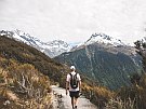
Introducing the LEARNZ Explore outdoors field trip

Explore more on Instagram @learnztrips, #LEARNZexploreoutdoors