You can contact LEARNZ, part of CORE Education, at:
Postal Address:
PO Box 13 678,
Christchurch 8141,
New Zealand
Alright, so you've got a basic idea of how we've been mapping the oceans, thanks to pioneers like Polynesian explorers, Captain Cook, and the tech evolution in hydrography. But, as with everything, there are challenges we're facing today, and some pretty cool innovations on the horizon that could change the game. Let's dive into what's up with the future of hydrographic surveying.
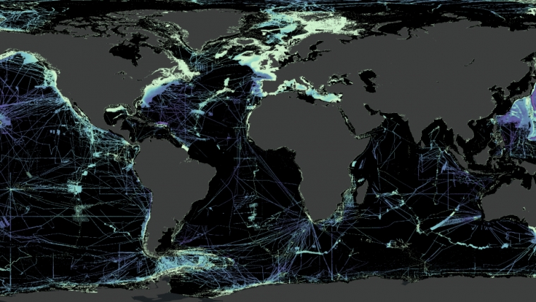
1. Deep-sea mysteries: Believe it or not, we know more about the surface of Mars than we do about our own ocean floors. Over 80% of the ocean is still unexplored and unmapped. Why? Because it's tough down there. The deeper you go, the darker and more pressure-packed it gets. Traditional mapping technologies struggle with this, making deep-sea surveying a massive challenge.

2. Shallow waters, big problems: On the flipside, sonar kind of flops in shallow waters – it just doesn't work well. So, hydrographers switch gears and use methods like satellite imagery to peek at the ocean floor from space, and airborne lidar bathymetry, where they fly over with lasers to map out the underwater landscape.
3. Time and money: Mapping the ocean is no quick weekend project. It's a colossal task that requires a ton of time, sophisticated equipment, and a whole lot of money. This makes comprehensive hydrographic surveying a resource-heavy endeavour.
4. Weather: Hydrographers can’t map very well if the weather is bad and there are some rough seas out there.
5. Climate change: Yep, climate change messes with hydrographic surveying too. Rising sea levels and changing ocean conditions mean that maps need constant updates to remain accurate. This is a moving target that's hard to keep up with.
Now, for the exciting part. Despite these challenges, the future of hydrographic surveying is bright, with innovations that sound like they're straight out of a sci-fi movie.
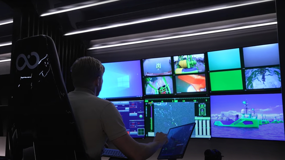
1. Autonomous and fully remote vessel fleets: Imagine robots exploring the ocean depths, mapping as they go, without needing a crew to operate them. Autonomous and fully remote vessel fleets are set to revolutionise how we explore and map the oceans, making it possible to reach previously inaccessible areas without breaking the bank.
2. Remote operation centres: Related to the above, people will be controlling things from a distance more. It’s safer working from the shore and you don’t have to spend so long away from home.

Source: Ocean Infinity - https://www.youtube.com/watch?v=yv_0fAeMvLE.
3. Satellite-derived bathymetry: Who says we need to be on the water to map it? New satellite technology can measure the ocean's depths from space by analysing how the water absorbs and reflects sunlight. This could be a game-changer for covering vast areas quickly. There are also satellites that shoot lasers from space, such as the ICESat-2 – designed to survey ice but because it uses a green laser it can shoot through clear, shallow water.
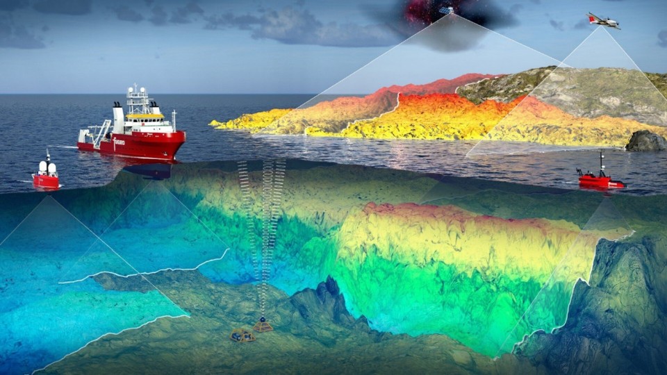
4. Combined sensor surveys: Using multiple tools for a complete picture, such as satellite imagery to map very shallow, lasers from planes a bit further out, and then sonar to map the deeper water.

Source: Fugro - https://www.fugro.com/news/long-reads/2020/world-hydrography-day-future-....
5. Artificial intelligence (AI) and machine learning: AI is not just for playing chess anymore. In hydrography, AI and machine learning can process the mountains of data collected by survey ships, AUVs, and satellites, identifying patterns and improving the accuracy of ocean maps at a speed that humans can't match.
6. Crowdsourced data: Imagine every ship out there turning into a mini survey vessel, collecting and sharing data. Thanks to advancements in technology, ships and even recreational boats can contribute to our understanding of the oceans, filling in the gaps left by traditional survey methods.
The ocean is our final frontier on Earth, and hydrographic surveying is how we're charting it. Despite the challenges, the innovations on the horizon promise to take us deeper and with greater accuracy than ever before. So, who knows? Maybe the next great explorer mapping the unseen depths of our oceans will be you, armed with technology we can only dream of today. The ocean's mysteries are vast, but so is our potential to uncover them.

Try the Challenges and future innovations quiz.