During the Geohazards 2015 field trip you will be investigating geohazards in Marlborough, including earthquakes, tsunami and landslides.
During the Geohazards 2015 field trip you will be looking at geohazards in Marlborough, including earthquakes, tsunami and landslides.
Geohazards in the Marlborough Region
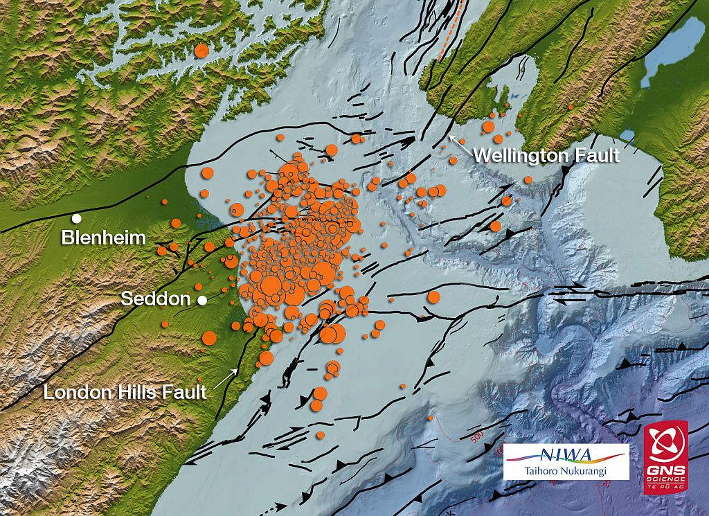
Geohazards are common in the Marlborough Region. The northern end of the Alpine Fault splits into several parallel faults that spread out across this region. There have been several recorded earthquakes in the region including in 1848 and 2013, and a tsunami in 1855.
Because of its proximity to active faults Marlborough region is, not surprisingly, one of the most seismically active in New Zealand and a very good place to explore the nature of geohazards!
Cook Strait earthquakes
Seddon earthquake
In 2013 a magnitude 6.5 earthquake known as the Seddon earthquake occurred:
- it was centred in Cook Strait, around 20 kilometres east of the town of Seddon in Marlborough
- the earthquake struck at 5:09pm on 21 July 2013 at a depth of 17 kilometres.
- it followed two earlier shakes of magnitude 5.7 and 5.8
The quake caused moderate damage in the wider Marlborough area and Wellington, 55 kilometres north of the epicentre. Only minor injuries were reported. Several aftershocks occurred during 21–29 July.
The Seddon earthquake is related to a second major earthquake which occurred on 16 August known as the Lake Grassmere earthquake.
Lake Grassmere earthquake
This earthquake had a magnitude of 6.6. The epicentre was located about 10km south-east of Seddon, under Lake Grassmere, at a depth of 8km.
This earthquake caused;
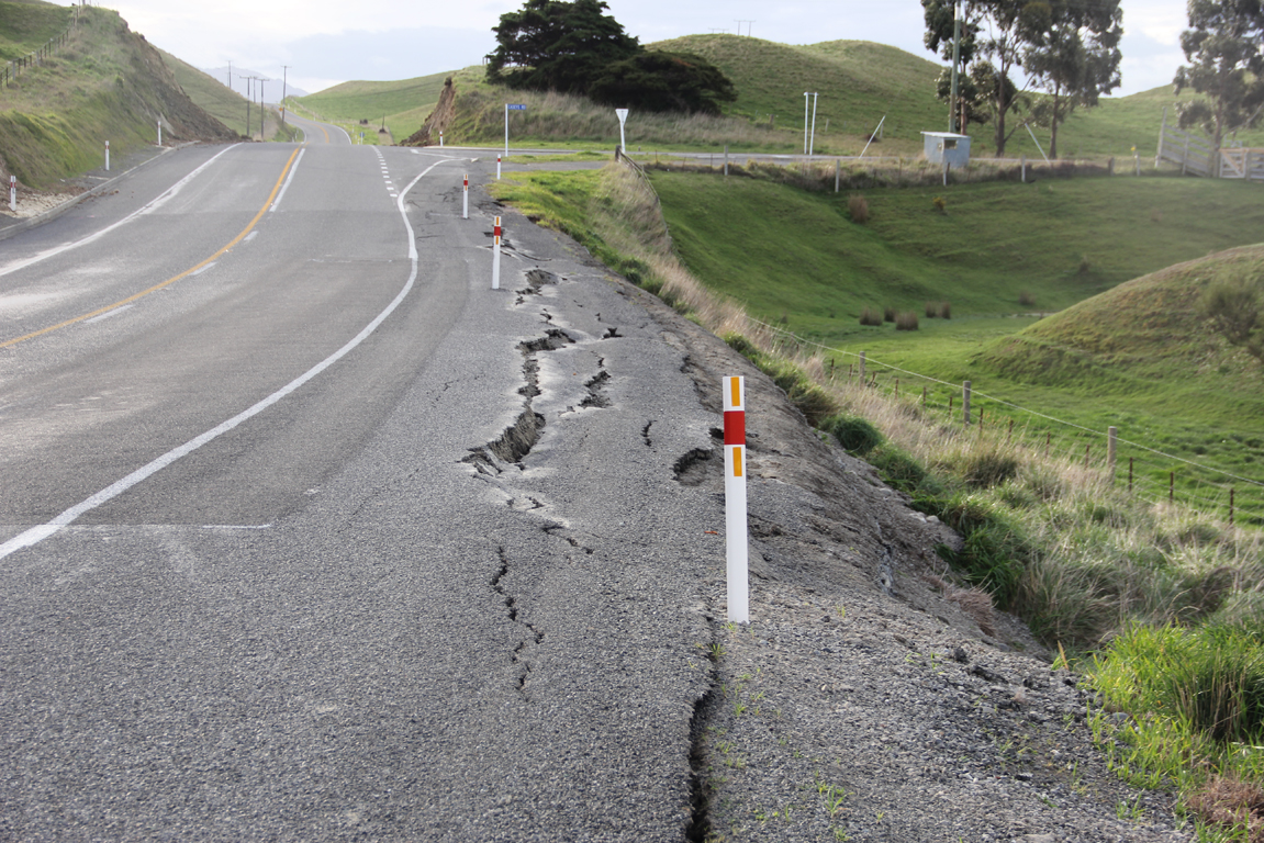
- significant land damage in the local area, with landslips
- slips blocked roads, including the main highway between Blenheim and Christchurch
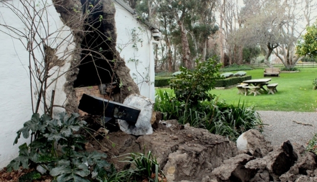
- damage to buildings in Seddon with some having to be demolished.
The earthquake was widely felt in both the North and South Islands of New Zealand.
In Wellington, the earthquake caused minor damage to buildings, breaking some display windows and cracking plaster.
This earthquake occurred on an adjacent fault to the July earthquake. It started its own aftershock sequence.
Other geohazards in Marlborough
Marlborough also has hazards related to landslides, particularly in areas that have been developed for farming.
Marlborough has also been affected by tsunamis in the past. In 1855 the Wairarapa earthquake, which ruptured the Wairarapa fault east of Wellington, generated a tsunami with a wave height of 4-5 metres along the Marlborough coast.
Geohazards in Marlborough
Geohazards are common in Marlborough. The northern end of the Alpine Fault splits into several faults that spread out across this region. There have been some large earthquakes in the region including in 1848 and 2013, and a tsunami in 1855.
Marlborough is geologically active so it is a good place to learn more about geohazards.
Cook Strait earthquakes
Seddon earthquake
In 2013 there was a magnitude 6.5 earthquake known as the Seddon earthquake:
- it was centred in Cook Strait, around 20 kilometres east of the town of Seddon in Marlborough
- the earthquake struck at 5.09pm on 21 July 2013
- the earthquake occurred at a depth of 17km
- it followed two earlier quakes of magnitude 5.7 and 5.8
The quake caused damage in the Marlborough area, and 55 kilometres away in Wellington. Only minor injuries were reported. Several aftershocks occurred during 21–29 July.
The Seddon earthquake is linked to a second major earthquake which occurred on 16 August known as the Lake Grassmere earthquake.
Lake Grassmere earthquake
This earthquake had a magnitude of 6.6. The epicentre was located about 10km south-east of Seddon, under Lake Grassmere, at a depth of 8km.
This earthquake caused;
- land damage including landslips
- slips blocked roads, including the main highway between Blenheim and Christchurch
- damage to buildings in Seddon with some having to be demolished.
The earthquake was widely felt in both the North and South Islands of New Zealand.
In Wellington, the earthquake caused minor damage to buildings.
Other geohazards in Marlborough
Marlborough also has active landslides.
Marlborough has been affected by tsunami in the past. In 1855 the Wairarapa earthquake, near Wellington caused a tsunami with a wave height of 4-5 metres along the Marlborough coast.
Find out about the geohazards that exist in your own local area and compare them with Marlborough.
Find out about the geohazards that exist in your own local area and compare them with Marlborough.


