You can contact LEARNZ, part of CORE Education, at:
Postal Address:
PO Box 13 678,
Christchurch 8141,
New Zealand
Thousands of earthquakes occur in New Zealand every year. Most are too small to be felt. Earthquakes are caused when the stresses break the rocks of the crust (a sudden movement). If the break reaches the surface a fault line is created.
Earthquakes happen every day in New Zealand. Approximately14-15,000 occur in and around the country each year. Most earthquakes are too small to be noticed, but between 150 and 200 are large enough to be felt.
Earthquakes occur most often where two moving plates meet and press against each other, as they do in New Zealand. Stresses cause the rocks to break and create cracks. If the crack or fracture reaches the surface, it is called a fault.
Many of New Zealand's active faults have been mapped. Scientists do not know exactly how many faults there are as they are not always visible.
You can find out more about earthquakes in New Zealand on the GeoNet website.
Shallow earthquakes usually break to the surface to create faults. Sometimes the blocks of rock on either side of a fault suddenly shift to a new position in just a few seconds. This sudden release of energy sends out waves, which are felt on the surface as an earthquake. The strength of the earthquake depends on the area of fault that has shifted and the amount of movement. A small area and small movement creates a small earthquake.
The place where a fault ruptures is called the focus or origin, and the point directly above on the Earth’s surface is called the epicentre. The pulse of energy released by a fault movement radiates outwards as seismic waves, or shock waves.
The P-wave (primary or pressure wave) is a pulse of energy that travels quickly through the Earth and through liquids. It forces the ground to move backwards and forwards as it is compressed and expanded (similar to the way sound waves move through air). It is often heard rather than felt.
The S-wave (secondary or shear wave) follows more slowly, shaking the ground up and down at right angles to the direction of the P-wave.
For centuries before Europeans arrived, Māori had experienced rū whenua which means ‘the shaking of the land’. According to Māori tradition, earthquakes are caused by the god Rūaumoko (or Rūamoko), the son of Ranginui (the Sky) and his wife Papatūānuku (the Earth).
Rangi had been separated from Papa, and his tears had flooded the land. Their sons resolved to turn their mother face downwards, so that she and Rangi would not see one another’s sorrow and grieve more. When Papatūānuku was turned over, Rūaumoko was still at her side and was carried to the world below. To keep him warm there he was given fire. He is the god of earthquakes and volcanoes, and the rumblings that disturb the land are made by him as he walks about.
Several accounts of earthquakes experienced by Māori were recorded by European writers. They described two major earthquakes, at Taupō and Rotorua. It was said that at Rotorua a pā with about 1,000 people was swallowed up, and the area became a lake.
Māori also spoke of two earthquakes along the Whanganui River in the 1830s. During the 1838 earthquake there were huge landslides into the river. These landslides caused a backwash in the river that left canoes stranded high up on the cliffs. Another earthquake in 1839 uplifted river boulders.
The most powerful New Zealand earthquake in recent history occurred in the Wairarapa in 1855. During this magnitude 8.2 earthquake, land moved along at least 140km of the Wairarapa Fault. Where the movement was greatest, the land shifted across more than 18 metres along the fault. Part of the nearby Rimutaka Range rose more than 6 metres. This is the biggest known movement by a single earthquake to have been recorded anywhere in the world.
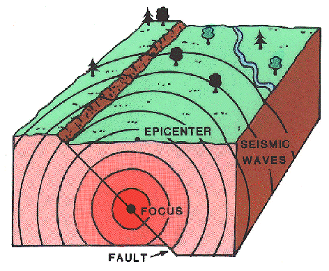
,The place where a fault breaks causing an earthquake is called the focus, and the point directly above is called the epicentre. Why do you think it would be important to know where an earthquake's epicentre is? Image: Public Domain.
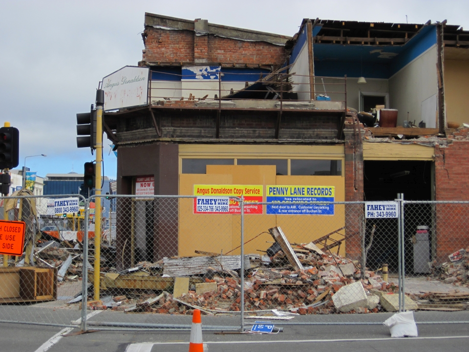
,Earthquakes can cause serious damage, especially to old buildings like this one in central Christchurch. Why do you think the Canterbury earthquakes of 2011 caused so much damage in Christchurch? Image: LEARNZ.
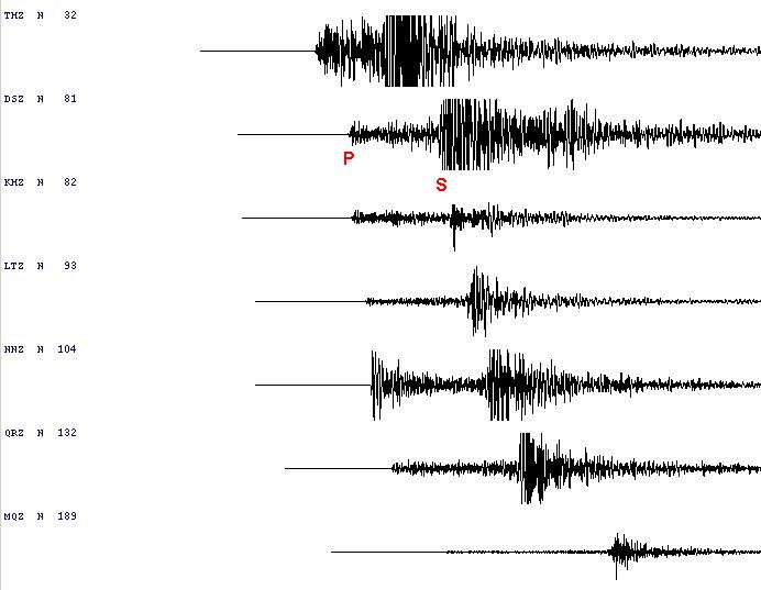
,The energy released by a fault movement radiates outwards as seismic waves. There are two types of seismic waves; P-waves and S-waves. What are the differences between these two wave types? Image: GNS Science.
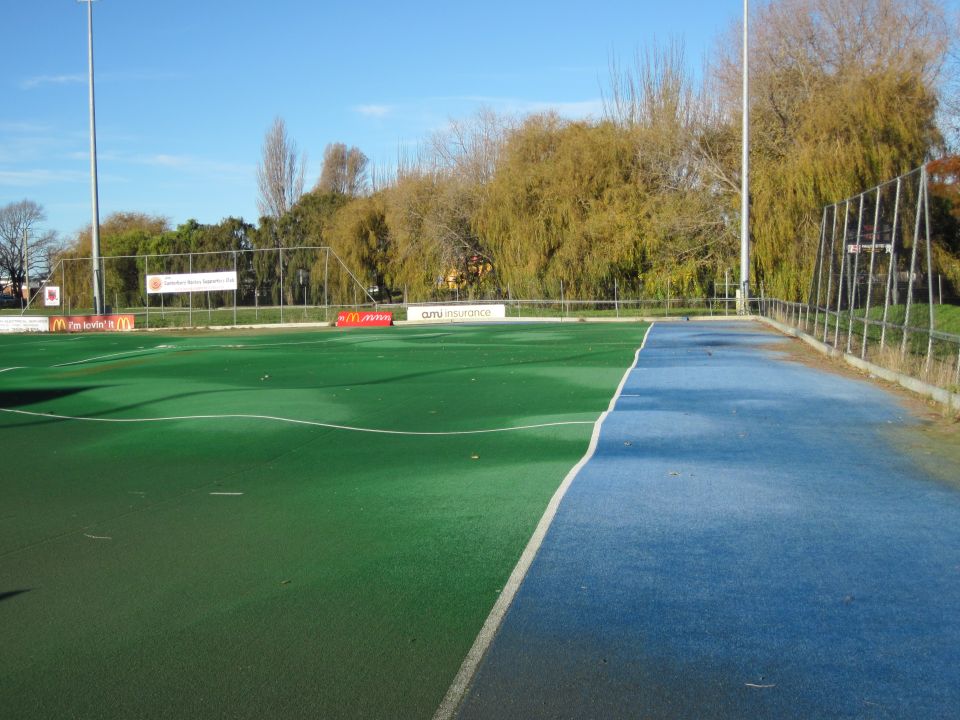
,Earthquakes affect different ground types differently. In areas of soft, wet ground such as the eastern suburbs of Christchurch liquefaction can occur. What is liquefaction and what damage can it cause? Image: LEARNZ.
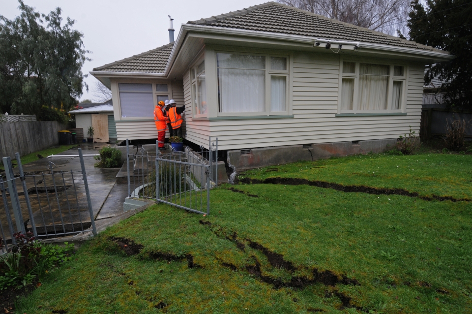
Earthquakes can cause land to move and sink, damaging houses. How do you think this damage could be minimised? Image: LEARNZ.
You can check out the GeoNet recent earthquakes webpage to see if there have been any earthquakes today and where they were centred.