You can contact LEARNZ, part of CORE Education, at:
Postal Address:
PO Box 13 678,
Christchurch 8141,
New Zealand
1. Why New Zealand has Geohazards mp4 file (65Mb) or watch on Vimeo.
Walk up to the lookout above the fur seal colony in Kaikōura to see how plate tectonics have shaped this area
Next step learning: Find out about the rate of uplift of the Southern Alps of New Zealand.
2. Tsunami and New Zealand mp4 file (55Mb) or watch on Vimeo.
Come down to the coast to find out more about tsunami and the risk of future tsunami in Kaikōura.
Next step learning: Find out which areas of New Zealand are most at risk from tsunami.
3. Earthquakes and New Zealand mp4 file (61Mb) or watch on Vimeo.
Drive up to a lookout over Kaikōura to talk with Rob about earthquakes and active faults
Next step learning: Find out more about the largest earthquakes in New Zealand’s recent history.
4. The Hope Fault mp4 file (68Mb) or watch on Vimeo.
Drive inland to Greenburn stream to see the Hope Fault.
Next step learning: The Hope Fault is one of the more active faults in New Zealand; what other faults are likely to rupture in the next 1-200 years?
5. Landslides mp4 file (61Mb) or watch on Vimeo
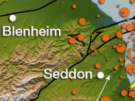
Take a break during your drive to Blenheim to investigate a recent landslide.
Next step learning: Find out if there have been any landslides in your local area and what has been done to manage the impacts of these.
1. The Cook Strait Earthquake Sequence mp4 file (63Mb) or watch on Vimeo
Drive south of Blenheim to Lake Grassmere to find out more about the 2013 Cook Strait earthquakes
Next step learning: Find out more about this sequence of earthquakes and compare this sequence with the Canterbury sequence.
2. Past Tsunami at Big Lagoon mp4 file (50Mb) or watch on Vimeo
Get permission from the farmer and drive out to Big Lagoon to learn about tsunami in this area.
Next step learning: Find out where else in New Zealand there have been tsunami.
3. Researching the Vernon Fault mp4 file (67Mb) or watch on Vimeo
Take a look at the trench that has been excavated through part of the Vernon Fault and find out what geologists can learn from this.
Next step learning: Find out about other fault lines in Marlborough.
4. Active Faults mp4 file (72Mb) or watch on Vimeo
Drive north of Blenheim up the Wairau Valley to find out more about the Wairau Fault.
Next step learning: Find out how geologists measure slow movement along fault lines.
1. Tsunami Risk in New Zealand mp4 file 57Mb or watch on Vimeo
Come out to the Boulder Bank in Nelson to find out more about this natural feature and tsunami risk in New Zealand
Next step learning: Find out which parts of New Zealand are at greatest risk from tsunami.
2. Detecting and Preparing for Geohazards mp4 file 48Mb or watch on Vimeo
Find out about how geohazards are monitored by the GeoNet monitoring network.
Next step learning: Check out the GeoNet website to find out about recent earthquakes.
3. Landslides in Cities mp4 file 76Mb or watch on Vimeo
Walk down to the beach at Tāhunanui to see where a large historic landslide has affected part of Nelson.
Next step learning: Find out which other parts of New Zealand are prone to landslides.
4. Landslides in Rural Areas mp4 file 66Mb or watch on Vimeo
Drive up a hill above Richmond to find out about one of New Zealand’s most common landslides.
Next step learning: Find about New Zealand’s worst landslides in recent history.
5. Field Trip Summary (mp4 file 73Mb or watch on Vimeo
Now that you have completed the Geohazard field trip, spend some time thinking about what you have learnt.